 |
Scroll down or click on Home to return back
Use Search engine below to fine more pages.
|
|
The Footpath at the rear of Higher Sea Lane, Charmouth.. |
| I have attempted to place all the information on my website below to puzzle out the history of the strange footpath at the bottom of Higher Sea Lnae that runs parallel to an ancient footpath linking in the Street to the Beach. If you wish to find more about the area click on:or https://www.freshford.com/thallata.htm or https://www.freshford.com/higher_sea_lane.htm. |
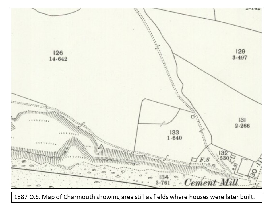
In 1864 Sir John Hawkshaw attempted to develop a railway line through the village with its own station from Lyme Regis to connect with the recently opened branch in Bridport, but when the Act went to Parliament it was opposed by Great Western Railway and did not succeed. A number of attempts had been made to link Charmouth with Bridport. In 1846 Isambard Kingdom Brunel had plans drawn up to connect his main line with the village, but it came to nothing. The most astonishing proposal was in 1874 by the Lyme Regis Railway who wanted to run a line along the coast from Lyme , then north of the Cement Works, where Thalatta is today, through the village and on to Bridport. With his inability to proceed with his line Hawkshaw placed all he had bought which included a big chunk of Lyme Regis up for auction in 1867, but it did not all sell and his son was to still own Lilly Farm up until the First World War. The map that went with the auction shows that Lot 31 which included the Cement Works with 64 acres, did not make its reserve of £4000. Lot 30, which was known as The Drang, went for £210 to James Cadbury and George Darby bought Lot 29 - Double Common for £185.
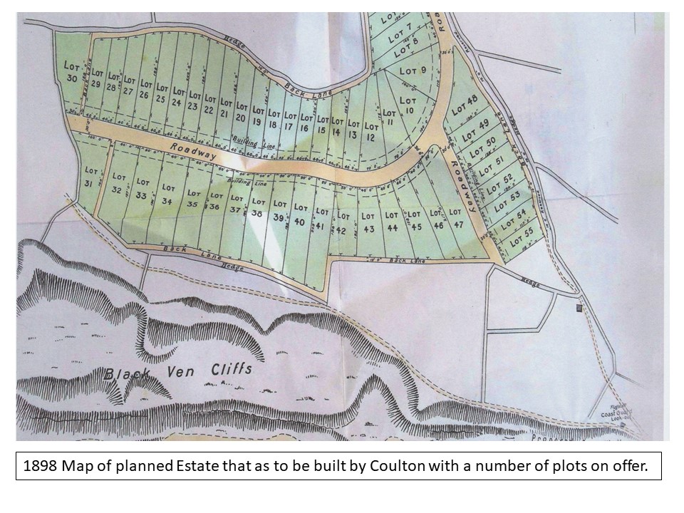
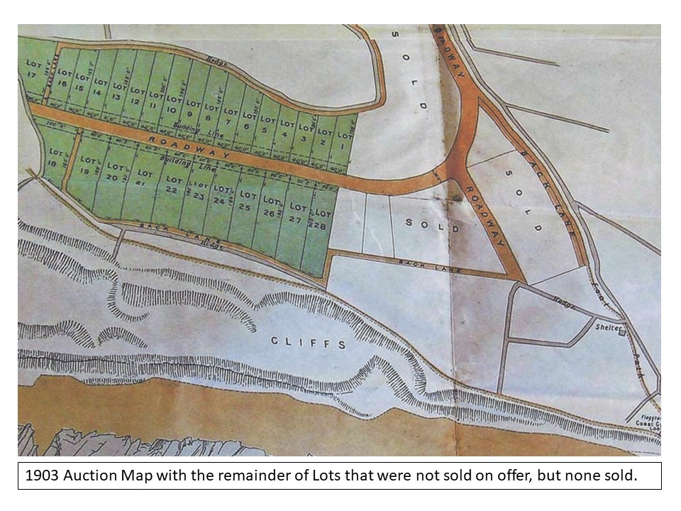
Three years later John James Coulton, a solicitor in Kings Lynn, bought Lot 30 for £3000 and for the next 30 years was to be the Lord of the Manor, even though he never lived here. By 1898 he had purchased the adjoining plot of the Drang from John Hodges and decides to divide it and the adjoining fields into 55 small plots, which he offered for sale. There is an interesting map showing in detail where these were to be and how Higher Sea Lane was to get a new road as, previously it only led to Double Common as the rest was fields known as Sea Lands. But it backfired on him and only a few were sold. Some of those built are the earliest houses in the Lane and include Roberts Cottage, Alberta, Lavender Cottage and Leslie Cottage. Again in 1904 he attempted to sell the balance of the plots, but no one turned up. Before he died in 1908 he was negotiating to sell the remainder of his estate to Alfred Pass of Wootton Fitzpaine. But both died in the same year and it was their sons who were to complete the sale and in that year Douglas was to buy the manor for £1400. He in due course sold fields off piecemeal. My own house, Thalatta was bought for £130 with an acre of land in 1922 by Miss Grace Icombe from Ealing who was to have a house built on it shortly afterwards. In 1938 Douglas sold the Cement Works and most of the foreshore to the Charmouth parish Council for £2974. That very briefly is the history of the Manor lands and how over the centuries they were was sold off. |
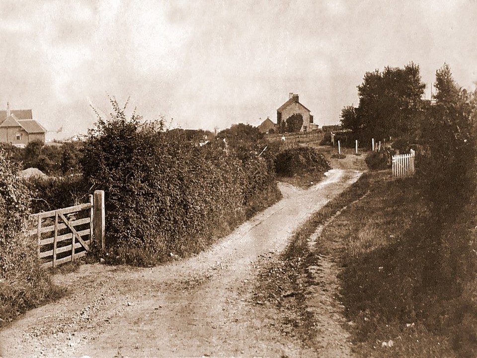
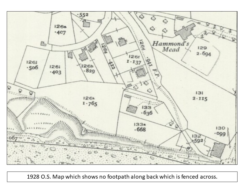
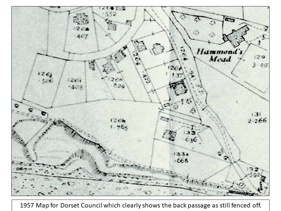
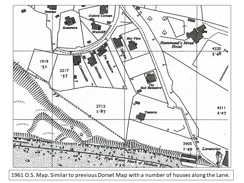
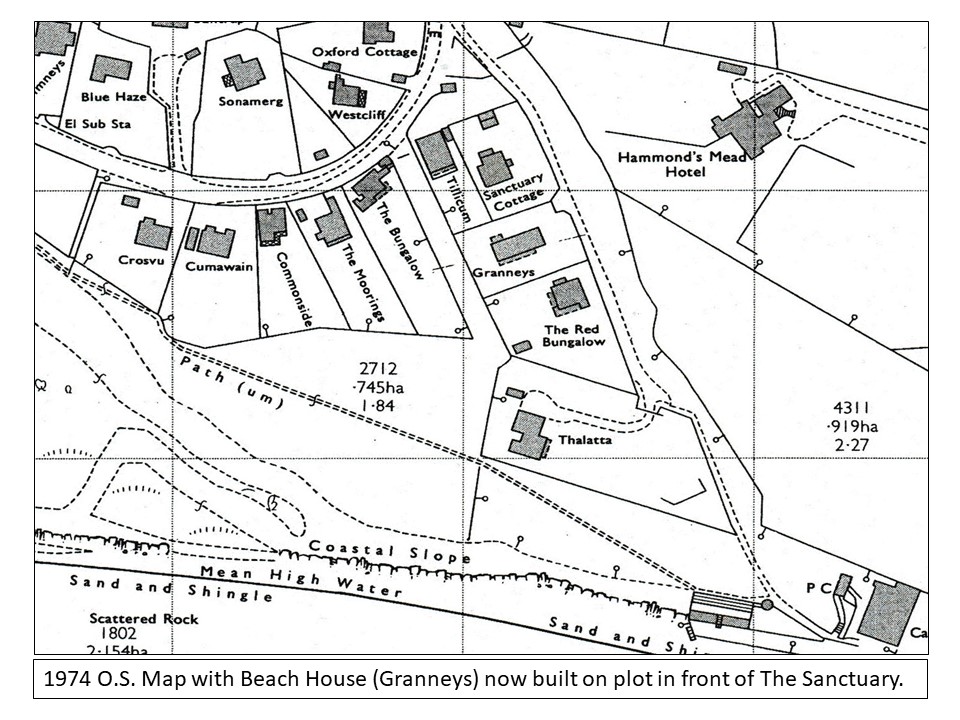
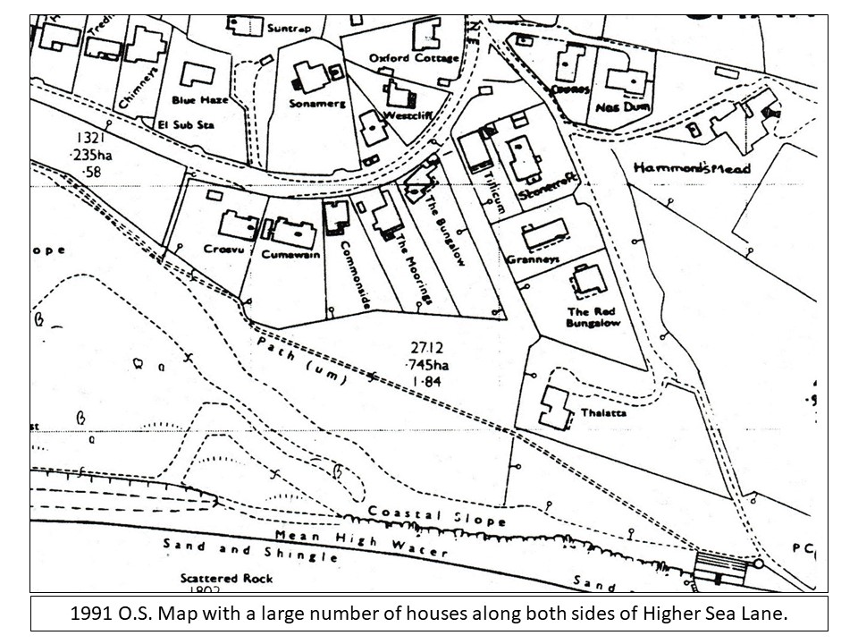
| Below are a number of Maps and images relating to the footpah. It would seem looking at them that John James Coulton had every intention of creating a large Esate on the fields at the bottom of Higher Sea Laneby selling at Auction a large number of plots and the buyers to build on them. A number of plots were sold in 1898 and several housds were built soon after including the Sanctuary which had a double plot. It can be seen from the maps that the original Roadway was to the west of several plots and the existing footpath (Back lane)to the east.. As the plot below The Sanctary had not sold Coulton must have changed his plans so as he could access to it and the enratnce to both th Sanctuarry and Red Bungalow were to come of the roadway to the east and the previous roadway wa not used. It would seem by the 1926 O.S. Map that it was fenced acroos and again in the later 1957 Vilage Map it is tsill fenced. From the 1961 O.S. Map onwards it is shown as open. |
|
|
 |
 |
 |
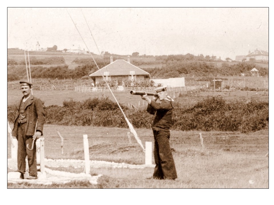
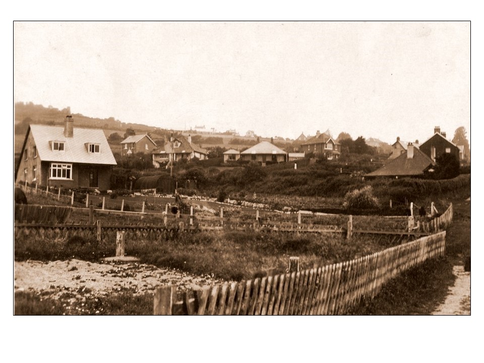
| The view in 1911 looking down Higher Sea Lane to Sanctuary Cottage with Hammonds Mead Hotel and its grounds on the right. |
 |
 |
| A view in 1991 looking up Higher Sea Lane. The builing nearest is the forer Battery used by the Coast Cuards for their ammunition. |
 |
| |
 |
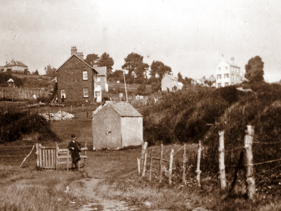
| A view taken in 1923 of the area with the Red Bungalow in the foreground and Cove Cottage and the Moorings in the distance. |
 |
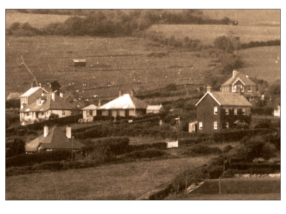
| A view of Thalatta soon after it was built in 1923 with Higher Sea Lane as a rough track to the sea. |
 |
| |
 |
| |
 |
| |
 |
| |
 |
| |